by Sara Dykman
Really there had never been much of a plan. Still, plan or no plan, it is good to know what country you are in. You want to avoid having to search out a village to ask "uhhhh... what country are we in". Trust us, we know.
We left Cochabamba with a loosely woven plan of biking to Uyuni, crossing Salar de Uyuni, and heading north for Lago Titicaca and Peru. And seeing as we feasted on pizza in Uyuni, wandered (and eventually crossed Salar de Uyuni), and are now heading north we are on track. So aside from a few confusing days of pedaling, a possible visit to Chile, a stretch of eating mostly crackers, a visit to an army base, one too many bowls of llama soup, and a detour to find some pavement, we are doing quite well.

We arrived in Uyuni and found a town built for tourists. It seems that when a Bolivian opens a restaurant for tourists they look to the other tourist restaurant until you can walk three blocks and find the exact same pizza-mexican-food-american-breakfast-vejitarian-food restaurant. The next step was to cross Salar de Uyuni, a huge and popular salt flat.
So there we were crossing the salar, just like planned. What we didn't plan for was being sick. The details are unimportant. But two miles onto the salt flat, we had to stop and make a new plan. Biking back to town was not an option. The 15 miles between town and the salt flat were some of the worst of the trip and already we had cycled that stretch twice. The few guides we asked couldn't give us a ride. Biking further into the salar seemed like a bad idea. So, we promised ourselves we would be better the next day and checked into a hotel on the salt flat made entirely (okay 95%) out of salt (***we would later learn that the salt hotel does not have an environmentally responsible septic system and thus it is best to not support this business***).

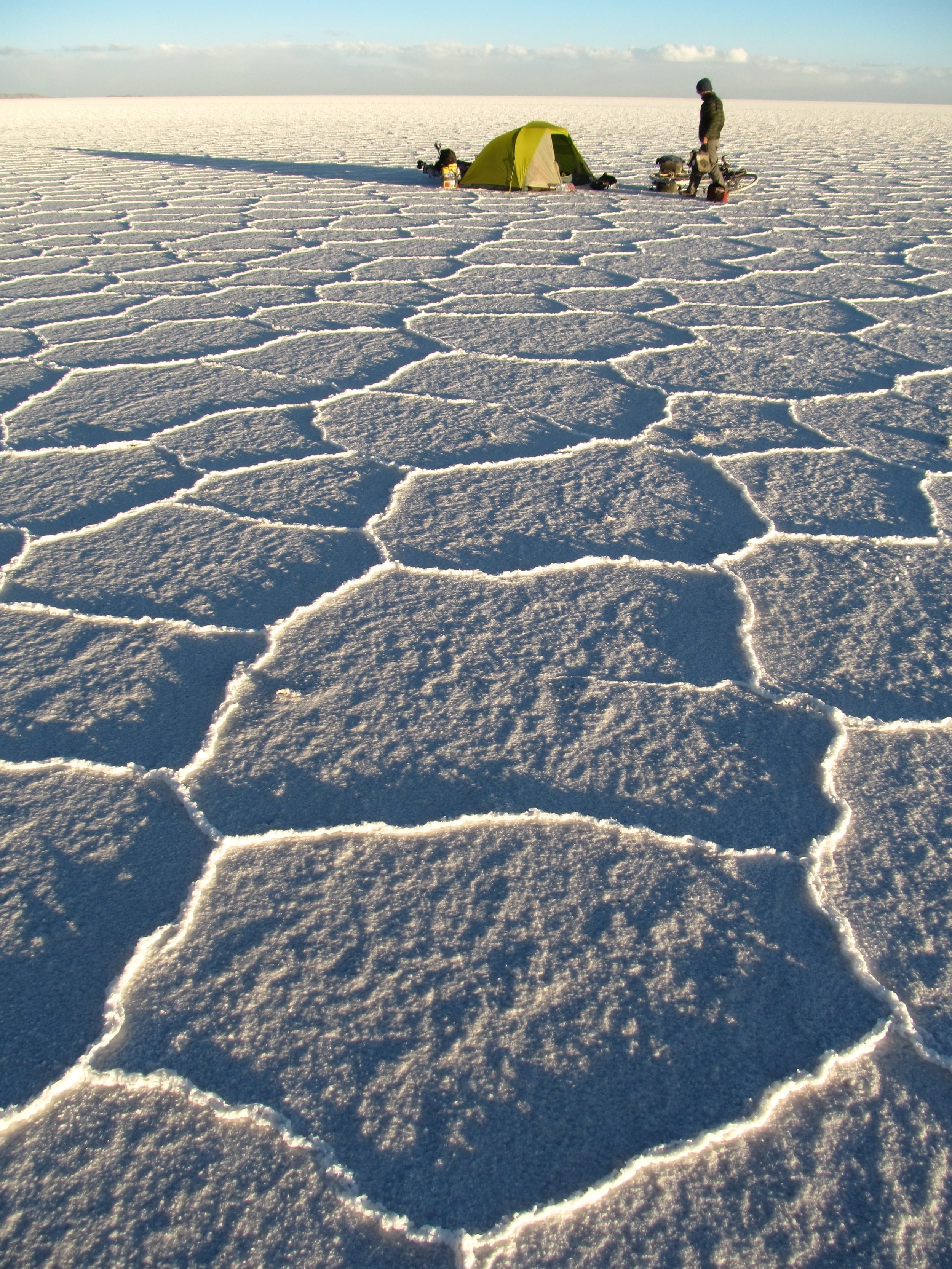
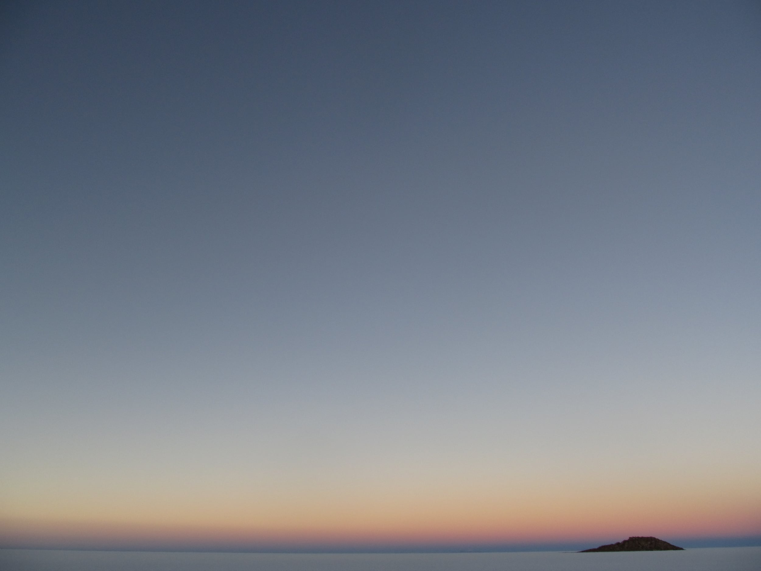
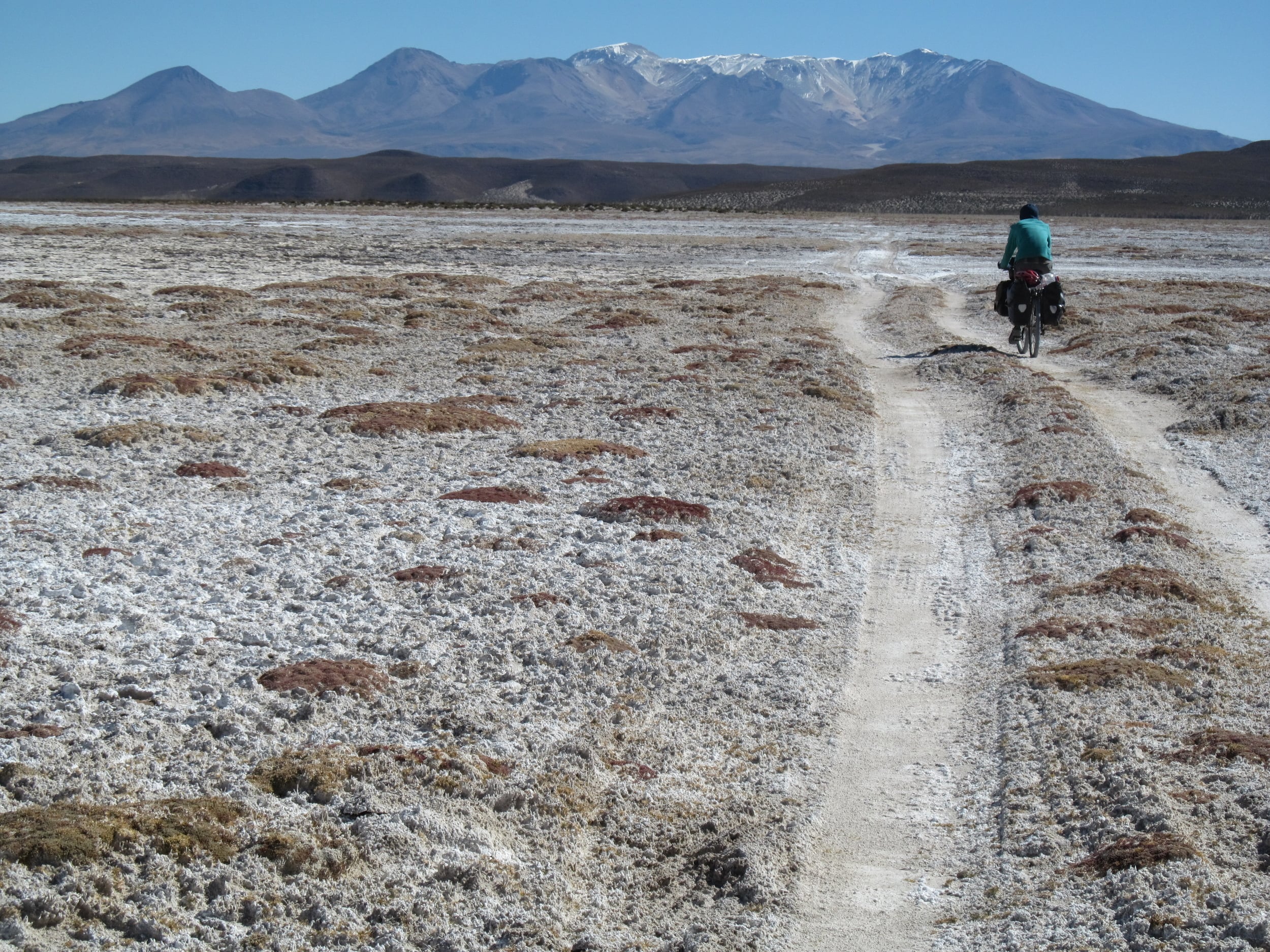
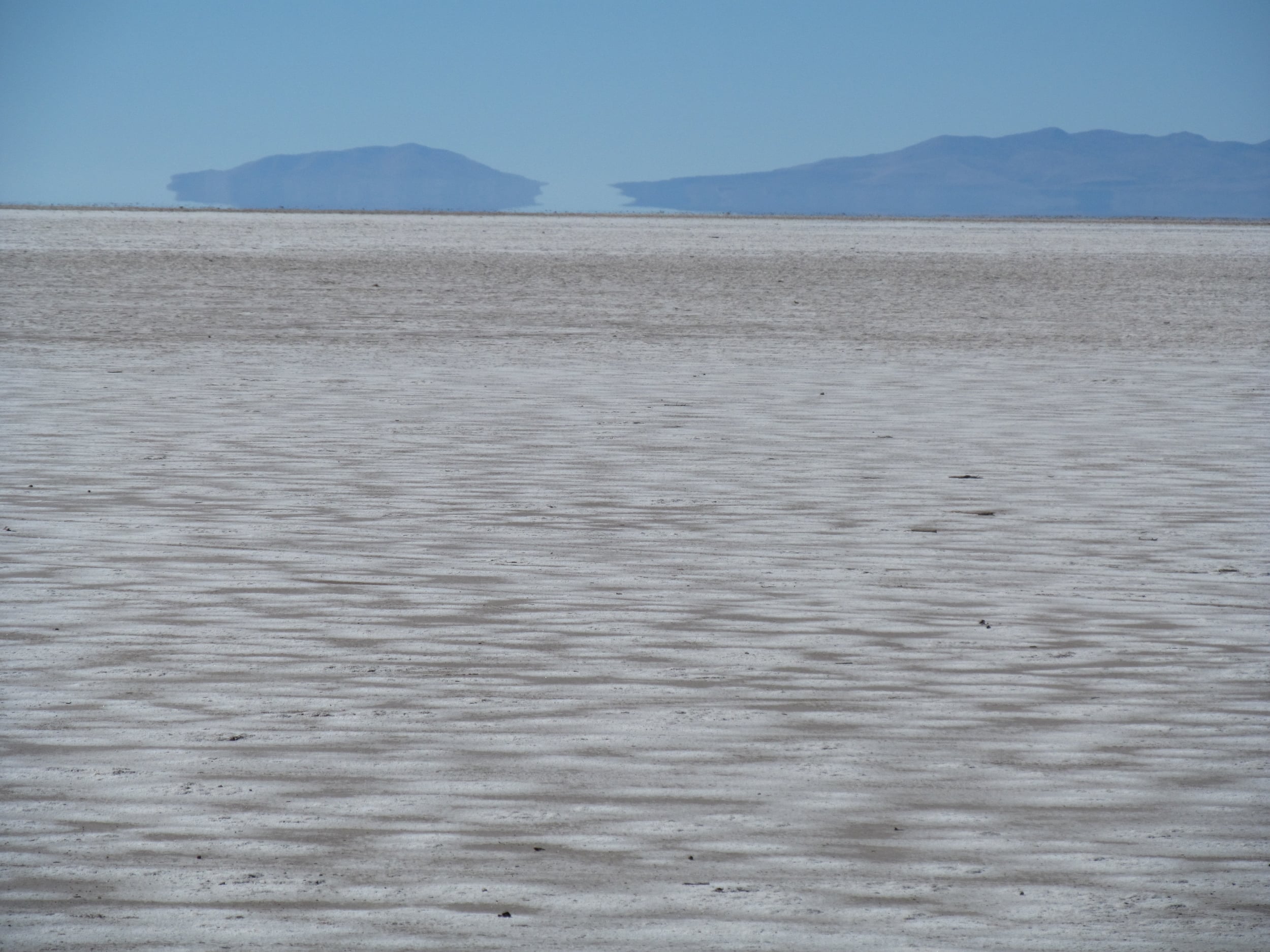
By the next day, we were back to the plan, biking across Salar de Uyuni. Biking across a giant salt flat takes biking to a new world. Never have I cycled so seamlessly without a road or even a route. The thick salt is smooth at the best of times, like riding on un-slippery ice. At the worst of times it is like biking on an old, paved road fighting disrepair. We go fast for the first time on the trip, and watch as the islands, almost swallowed in a sea of whiteness, get closer.

Salar de Uyuni is the world's largest salt flat and sits on the Altiplano. The Altiplano is a high plateau. Once at sea level the plateau was pushed to 12,000ft from the uplift of the Andes. As the mountains surrounding the newly formed Altiplano drained not just water but minerals like salt and lithium, a mineral rich and giant prehistoric lake was formed. As the climate shifted, there was not enough rain to maintain a lake and so the water evaporated leaving a lake like bed of salt. The crust of the salty lake dries thanks to the sun and wind, but below the salt is still wet. Even as we bike small holes in the crust reveal the briny waters below.
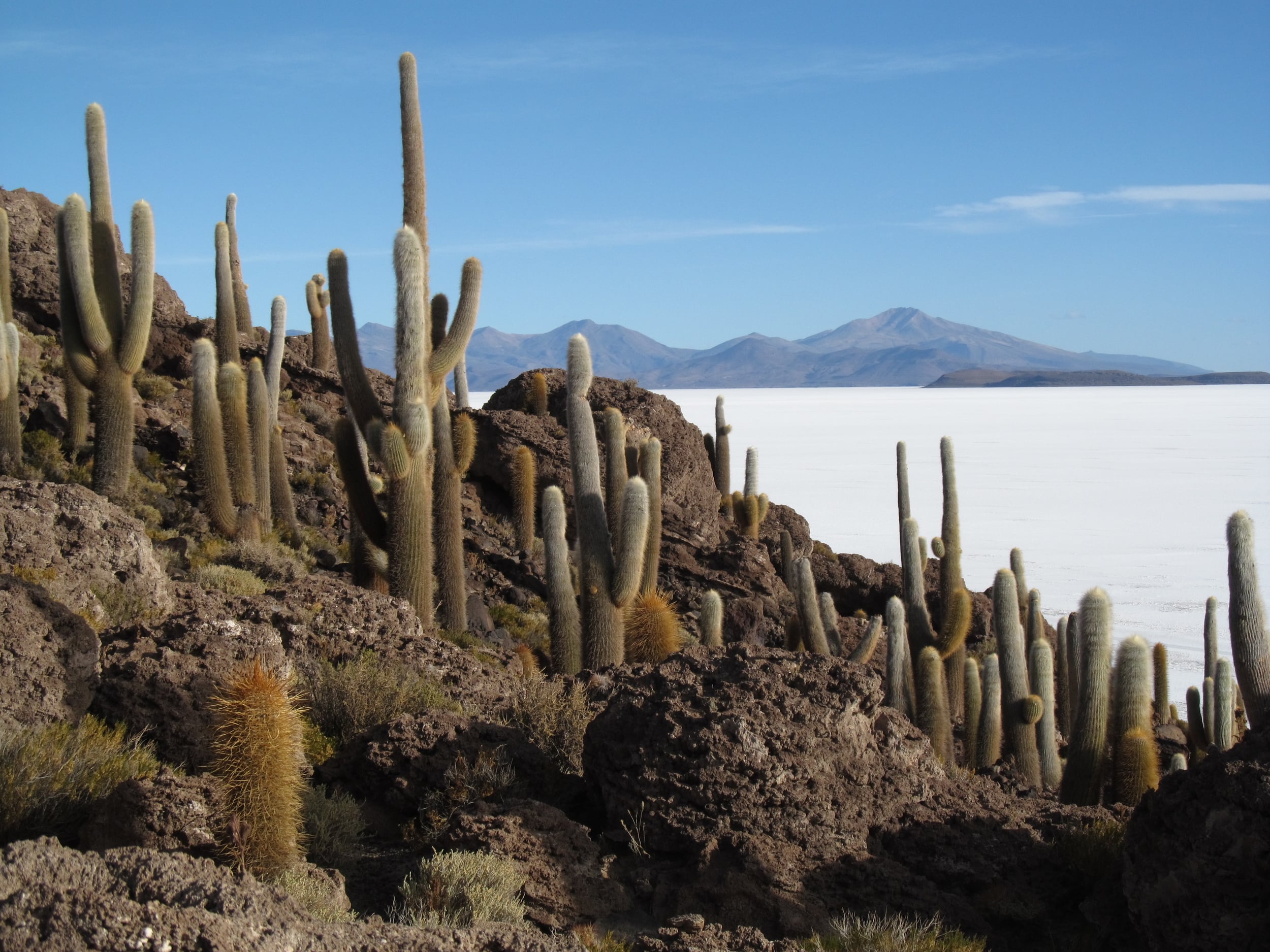
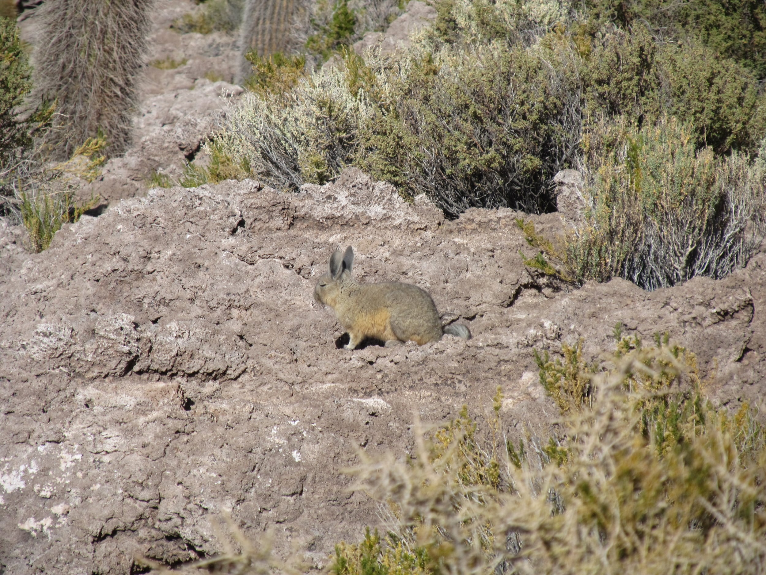
But we avoid these potholes in the white, salty crust. It is easy to do, because for miles there is no road, just darkened tracks from all the tour guides. Our bikes leave no tracks, and we go as we please. We visit the island where the majority of tourists are funneled to. This and other islands are in reality old, submerged volcanic peaks. Millions of years later they are covered in barrel cactus and home to strange creatures like the vizcacha, a rabbit like rodent with a long strange tail. But the cacti are my favorite. Like the saguaros of Sonoran Desert, they stand tall, like a crowd gathered on these strange islands to watch the whiteness of the salar fade to red at every sunset, then disappear into the night.
Night riding is one of my favorite things in the world. Normally when I bike tour, I like to watch the sun sink below the horizon I am chasing, and then ride with the light of the moon. Because you can only see so much, I always feel as if I am biking into a secret. The road and the moon and the darkness are mine, I just have to keep pedaling.
This love for night riding convinced me to ignore the freezing nights and promise my I-am-NOT-a-morning-person self to wake up before the sun and ride the salar with the light of the moon. Waking up early is better than waiting in the cold night for the moon to rise. And so, in the shinning hours of 4:30 am, when most people would be scared to wake me up, we get up and start biking. The moon's light bounces off the white salar. I think of the light of the sun reflecting off the moon then reflecting off the salar. That is awesome.

But it is cold, and so as the sun begins to rise we huddle into our sleeping bags, eat breakfast, and wait for the sun to warm the salar. Before it can we are both asleep. To the few passing tour guided jeeps, we must look like a strange crash-pile between two islands. So much for our early start.
Salar de Uyuni was the first salt flat we planned on crossing. After looking over google maps and a few other tourist blogs we decided to head north and cross the less well known Salar de Coipasa. Other cycle tourists reported few problems, just that the salt was a bit more wet and and sticky, and thus a bit slower to bike on than the larger Salar de Uyuni. Easy enough, right?
I can't actually explain what happened. I just don't know. My theory is that we left the road too soon, on a hard to cycle peninsula of Salar de Coipasa. When we grew tired of pushing our bikes we sought out jeep tracks and assumed going somewhere was better than going nowhere at all. We continued until the salty earth turned to sand. By then there was no going back. So we pushed and cycled and cursed through the sand.
Looking back it seems obvious, but that is really only because we found the salar a few days later. Next time, just because the ground is white we won’t assume that it is a salar. And next time, when we just find sand, we won’t assume that the salt was washed off to grow quinoa. AND next time we won’t believe our maps. We know what you are thinking, but sometimes, especially when you are lost, it is just easier to believe what you need to believe.

When we reach a big road (and by bigger I mean not a jeep track in the sand), we headed to the small village to figure out where we were. The village is a collection of adobe houses, failing rock fences, a few pieces of trash lost to the wind, and a scattering of pigs, sheep, and dogs. We cycle up to a group of men using a machine to shuck the locally grown quinoa. We smile as we approach, happy to see people. They smile as we approach, almost giggly seeing two tourists roll up on bikes. They will laugh even more when they learn we are lost. The conversation goes like this (in Spanish):
Me: Hello. Good morning. How are you? Where are we?
Man: [He looks up from shucking quinoa and says a name I don't recognize or understand]
Me: We want to go to Sabaya.
Man: You still have a long way to go. You have to cross the salt flat.
Me: We haven't crossed the salt flat yet!? [this is when I get out the map] Where are we [I point to a part of the map, between the well worn fold to a tiny part of southern Bolivia just north of two large salt flats]? I think we might be right around here.
Man: No, you are here. [He points to a spot on the map about 50 miles from where I thought we were. It's on a jetty like curve making the boarder between Chile and Bolivia]
Me: Seriously!!! What country are we in?
Man: ha ha ha, you are still in Bolivia [He points just past his village of adobe houses and wandering sheep to the hills], but Chile is right there.
The conversation continued and then we followed their directions to continue down the road, cross Salar de Coipasa, and eventually arrive at Sabaya. Sabaya was our goal. On the map it had the large dot, indicating if nothing else, there would be a store, maybe even a store with a potato or fruit. Again, sometimes it is easier to believe what you need to believe.
The good news, when we finally found Sabaya, was that the road was paved. After moving so slowly for one month, and watching the map without much progress, we decided to change plans for a bit and seek out paved roads. We knew that we would compromise some of the wildness and tranquility with a paved road, but it was a needed break.
The bad news, when we finally found Sabaya, was that there really was no food at all. This began a four day stretch of eating crackers with condiments and a lot of llama meat. Enough crackers and meat to write another blog about. So for now, let's just say that if you are what you eat, then Nia and I were crackers, condiments, milk, caramel, and llama soup.

The milk and caramel came a few miles after Sabaya. The road we were on continued to Chile and thus many times on the road we would pass military check points. Passing one check point in the town of Huachacalla, we chatted with the soldier and asked about the music blasting between the iconic white steepled church and the mixture of red and silver roofs. Everyone we found would explain the 7 day festival a bit differently, but the soldiers told us it was a celebration of a saint. Assuming we could at least find a potato we headed in.
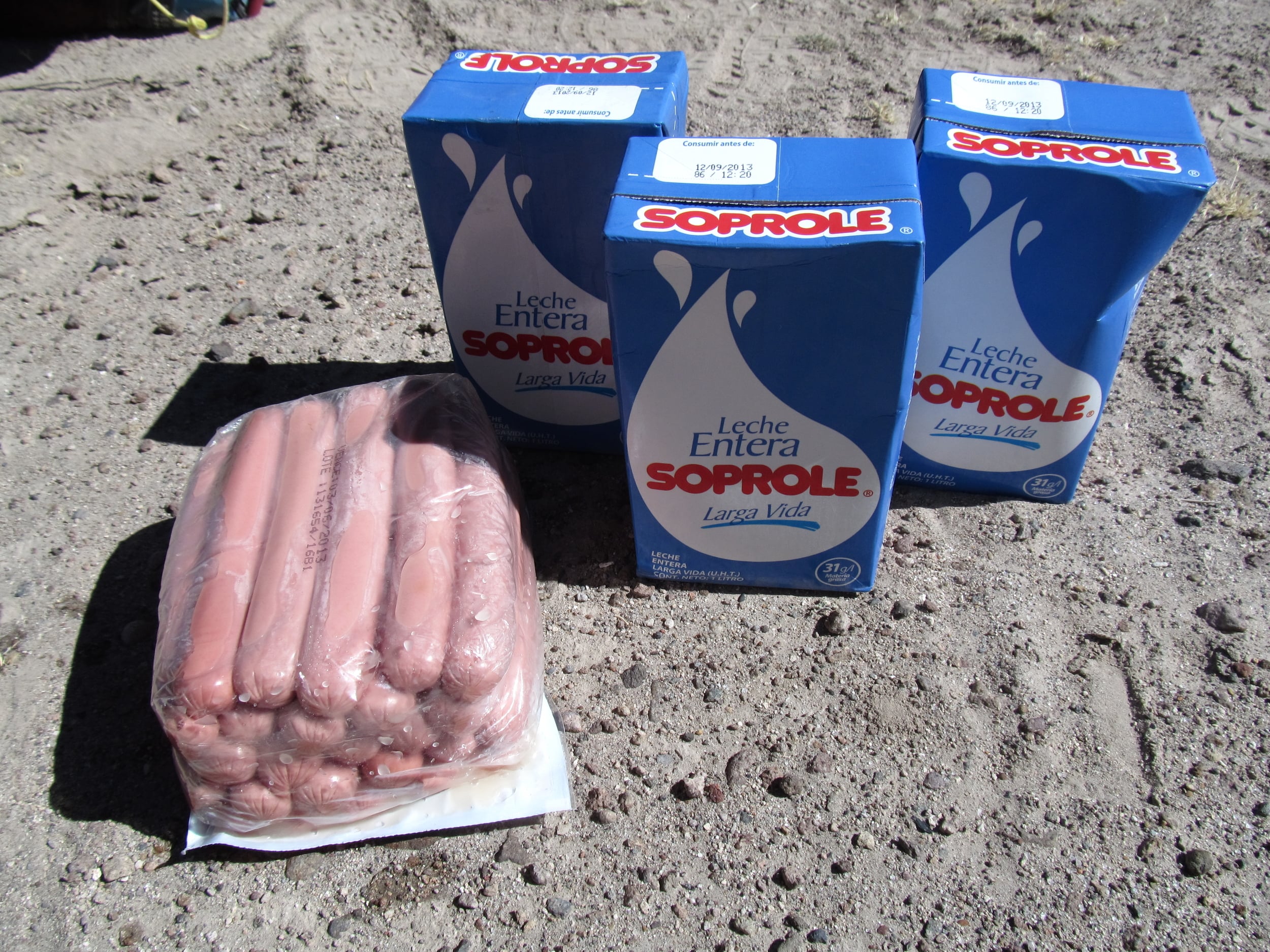
By the time we left Huachacalla a day later we still didn't have potatoes. We had entered the square with the music, and instead of potatoes we found people in celebratory dress, hauling instruments and beer. Huari to be specific. We didn't turn down a beer or the opportunity to give a cheer to Bolivia and its people. That first beer paved the way to meet the Major of the regiment and accept a place to stay in town. It was fun to take a break in a small town. The next day the Major and his family would treat us to breakfast and send us on our way with three cartons of milk, caramel, a huge packet of hot dogs, and juice.

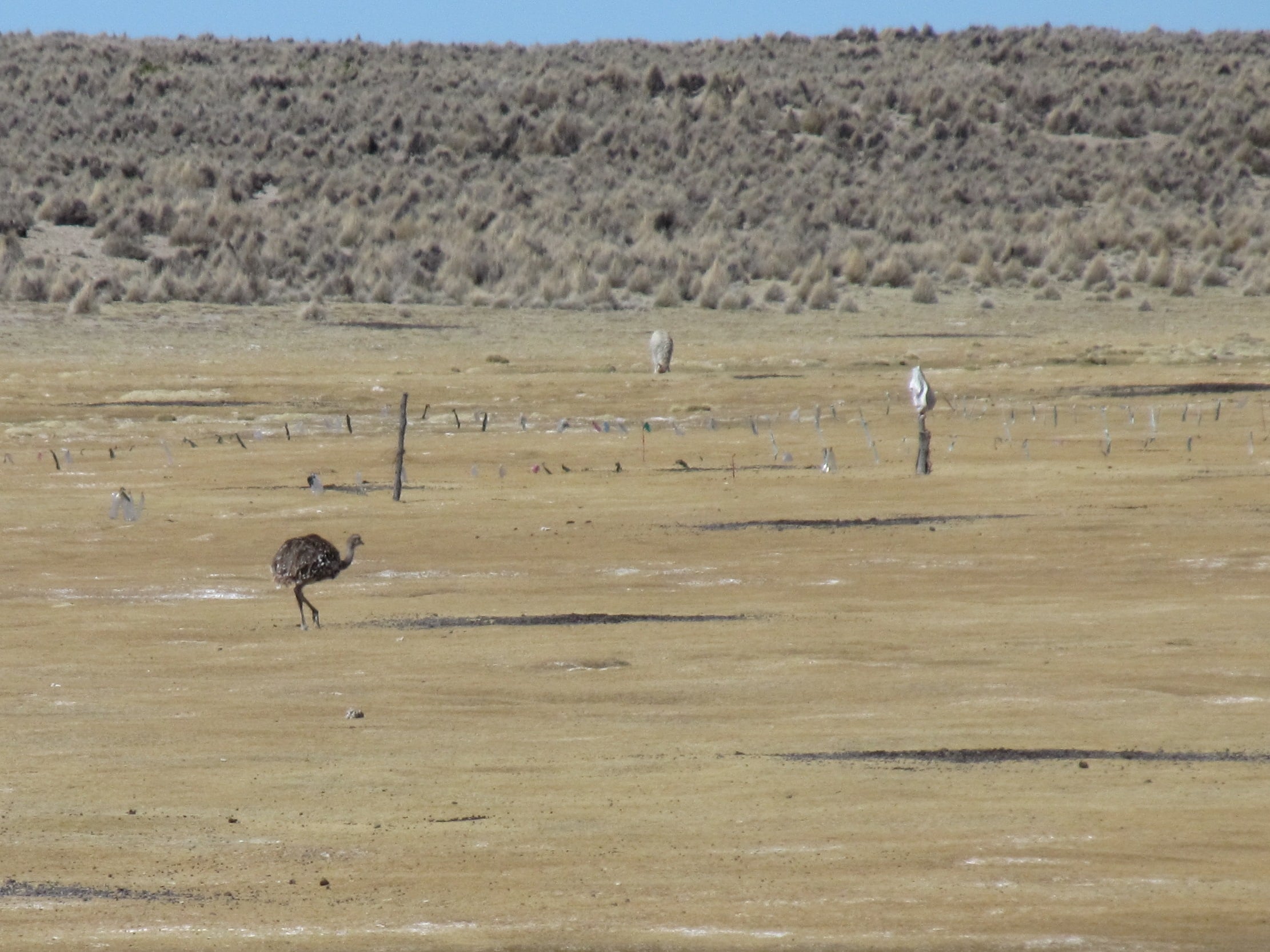
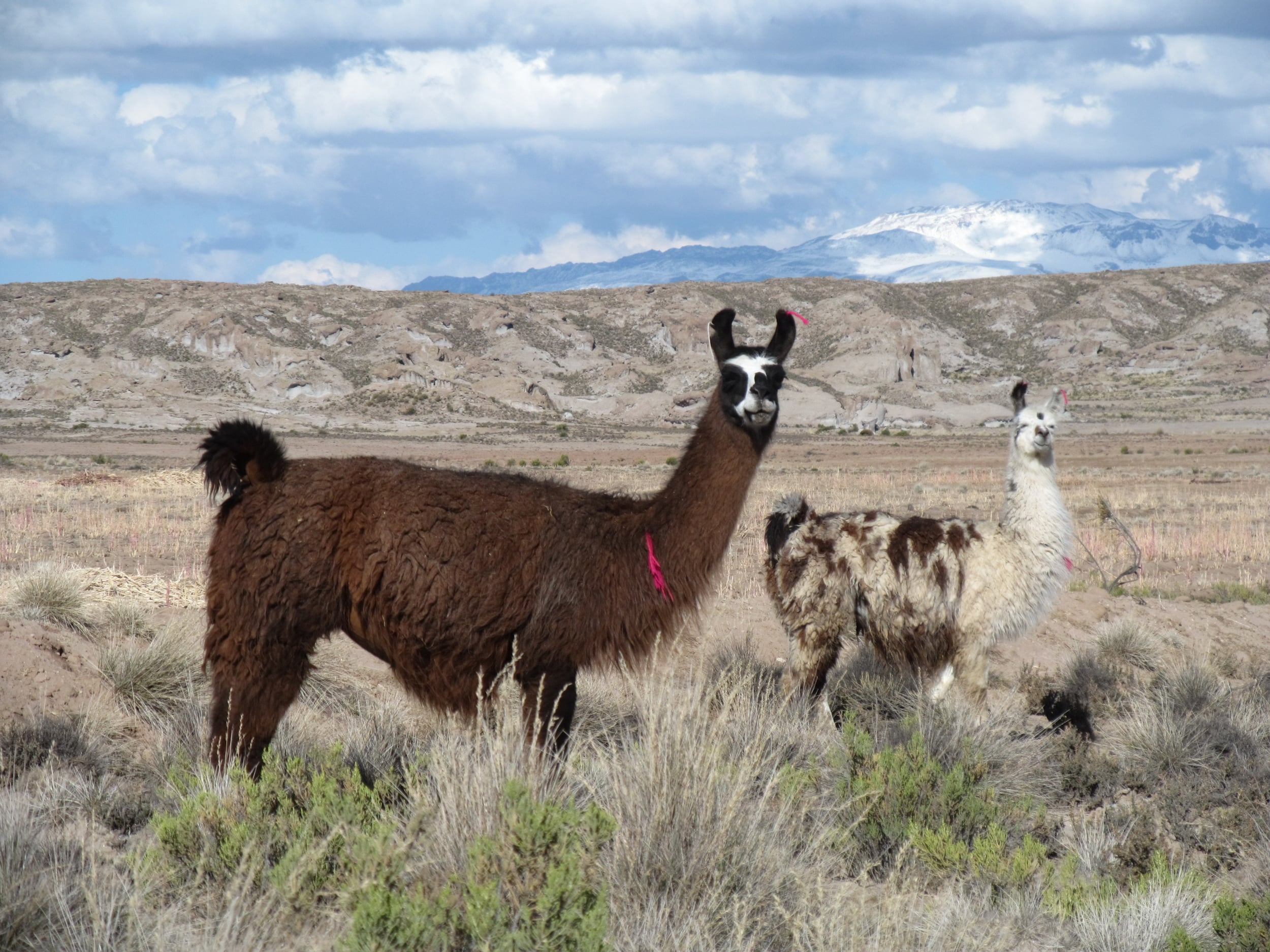
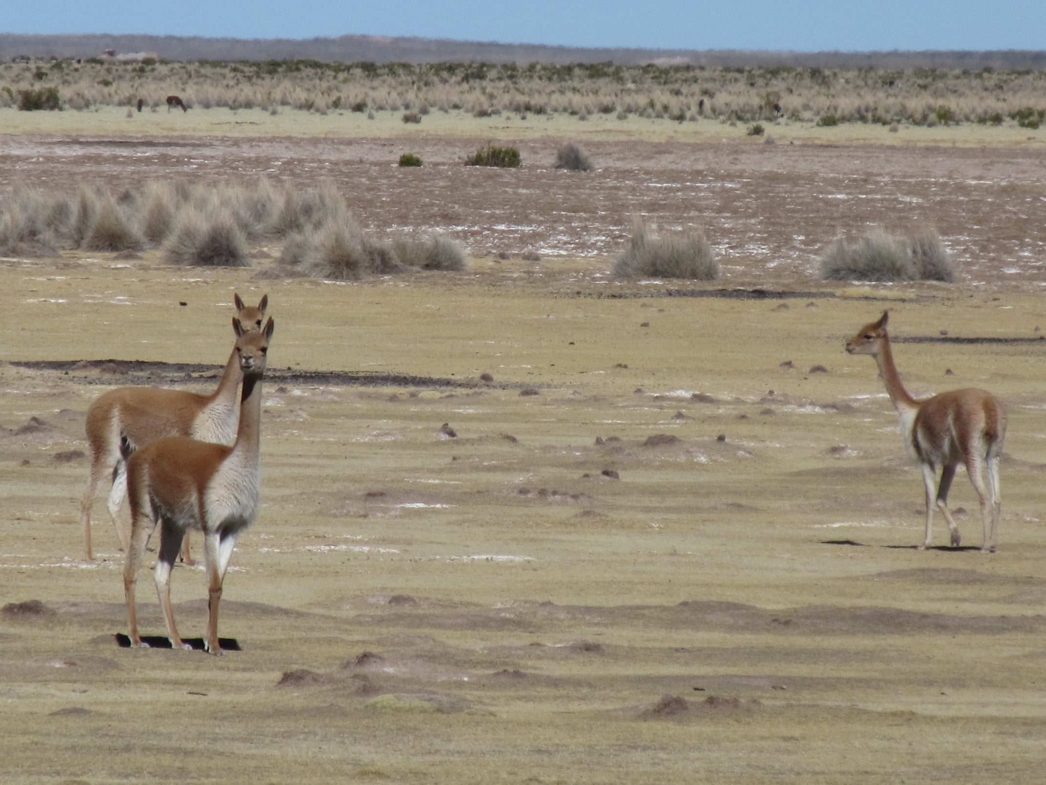
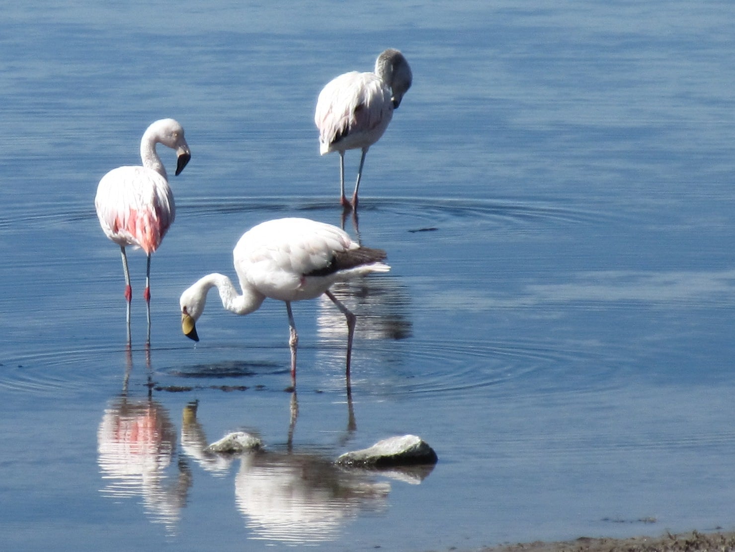
From Huachacalla the road was easy and relaxing. Oruro, the biggest town we had seen since Cochabamba, hung on the horizon and inspired many hours of daydreaming about what we would eat and how much of the time we wouldn't do anything. Two of the next three days were on a paved road with a nice shoulder and not too much traffic. Not having to concentrate so hard on the road we could watch the llamas that graze like cattle, the native vicuñas running from the danger we presented, flamingos sifting through the roadside ponds and lakes, and even two rheas relaxing (a giant flightless bird).
Arriving in Oruro we are reminded that we are entering a big city. We bike by miles of garbage made possible by the convenience of plastic and nowhere to put it. We become alert to the growing traffic. AND we feasted on fruit and veggies and whatever else we could find. The feast didn't end with food. One of our friends from Huachacalla and his cousin who live in Oruro bought us a room in a nice hotel and treat us to a traditional Bolivian meal. ¡Viva Bolivia!

In Oruro we relaxed and started "planning" the next leg of our trip. And by planning I really just mean deciding which direction to go and what road we might ride in the next few days. Because plans are just plans. For now we are happy knowing we are in Bolivia and heading north.
